Cim de la Safor Hiking Route
The Cim de la Safor Route is one of the most challenging hiking trails in the region, perfect for those seeking a full physical experience. With a spectacular ascent that will take you to the summit of one of the highest peaks in the area, Cim de la Safor.
An Impressive Ascent Through Forests and Mountain Landscapes
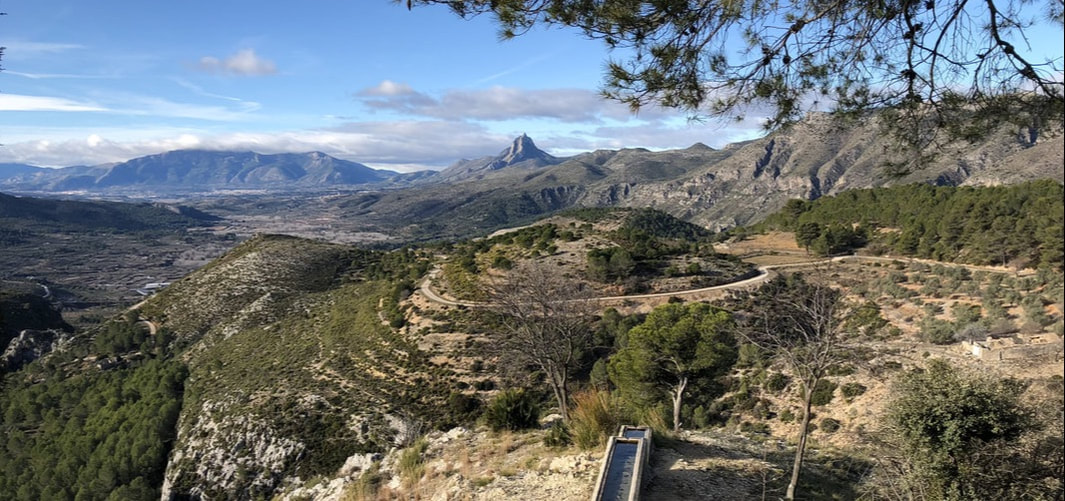
The Cim de la Safor Route begins with a spectacular ascent, taking hikers to the well-known ‘Ventana de La Safor’, a natural viewpoint offering panoramic views of the region. As you continue, you’ll venture into small oak forests and paths surrounded by fallen trunks, making the route both challenging and visually striking. After a brief descent to the ice house “The Nevera”, the trail ascends again until reaching the summit, where you’ll be rewarded with unparalleled views of the surrounding valleys and mountains.
The descent also presents its own challenge, with some technical sections that will take you to Font dels Olbits, before continuing along an asphalted path to the parking area. This route not only challenges your physical abilities but also allows you to enjoy a natural environment full of beauty.
Hiking Route:
Cim de la Safor
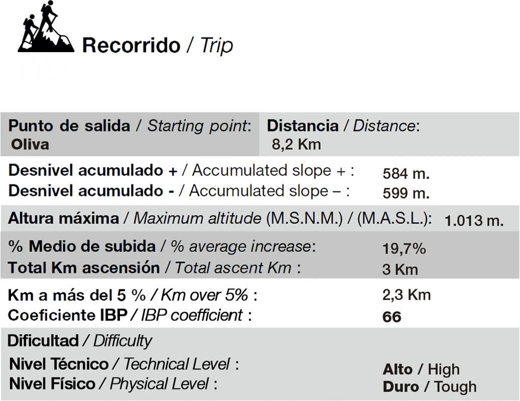
The Cim de la Safor Route has a total distance of 8.251 meters, with a maximum altitude of 1,006 meters. This route is perfect for those seeking a serious challenge, as its ascent is demanding, but the views from the summit make every effort worthwhile. Along the route, you’ll experience a mix of mountain landscapes, forests, and panoramic views, making the physical effort entirely rewarding.
Km distance
Positive Elevation
Negative Elevation
Maximum Altitude
Cim de La Safor
Now you can explore the Cim de la Safor Route on your own with the downloadable GPX file. With this file, you can easily follow the route on your mobile device or GPS, allowing you to enjoy the experience at your own pace. The file includes all the route details, from the initial ascent to the technical descent, so you can manage your time and effort efficiently. Download it now and enjoy the beauty and challenge offered by the Cim de la Safor!

Max elevation: 1006 m
Enjoy the Route at Your Own Pace: Download It and Live the Adventure!


Professional Guide Service for Hiking Routes
At Tracks And Pedals, we take pride in offering specialized hiking guides for routes across La Safor, Oliva, and the central regions. With enough time and preparation, we have also organized guided hikes throughout the entire country. As passionate hiking enthusiasts, we provide an unmatched experience.
What Do Our Customers Say?
Here are the direct opinions of our customers and friends about our services. Remember, with us you can count on everything to enjoy nature through road cycling, as we have everything you need: high-end, mid-range, and beginner Road Bikes from top brands, GPS devices, guides to accompany you on your routes… Whatever you need… Read the reviews and decide for yourself.
hola@tracksandpedals.es
BIKE WORKSHOP
Bike owners have a trusted ally in us. We offer specialized technical services to keep your bicycle in perfect condition, repairs, maintenance, and upgrades to ensure your machine is always up to date.
BIKE SALES
Our commitment is to provide you with an unmatched shopping experience, backed by the excellence and passion that define TracksAndPedals. We are the leading bike retailer in Gandia, Oliva, Safor, and Marina Alta, offering top brands like Aurum, Cube, Merida, and Rali.
BIKE HIRE
We have a wide range of high-quality rental bikes available for you to enjoy your passion in Oliva, Safor, Marina Alta, and Central Regions. Whether it’s leisurely rides along greenways, challenges on dream-like roads, or the most demanding single tracks you can imagine—we’ve got you covered.


